The U.S. Air Force has unveiled a cutting-edge mobile application designed to streamline airfield assessments for aircraft operations in austere environments. Developed by the 435th Air Ground Operations Wing Innovation Team at Ramstein Air Base, Germany, this new tool promises to enhance the speed and accuracy of determining whether an airfield can safely accommodate aircraft such as the C-130 Hercules or C-17 Globemaster III. The innovation marks a significant step forward for agile combat employment.
Accelerating Airborne Operations
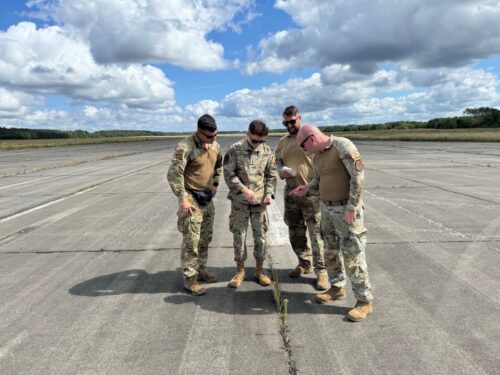
The traditional method of assessing airfields has long been a time-consuming process, relying heavily on manual calculations and pen-and-paper documentation. Staff Sgt. Justin Salvione, an airborne air traffic controller with the 435th Contingency Response Squadron, explains the challenges:
“When we go out to survey a landing zone, we evaluate everything from the strength of the landing surface to the glide slope ratio, ensuring there’s enough clearance for an aircraft to land safely,” Salvione said. “Traditionally, this meant compiling data manually, which could take hours and leave room for human error.”
The new app dramatically accelerates this process, allowing assessment teams to input data directly into their devices while in the field. The app then automatically calculates the viability of the airfield for different aircraft, providing immediate feedback on each criterion.
Enhancing Decision-Making for Aircraft Deployment
One of the most significant advantages of this digital approach is the rapid generation and sharing of reports. 1st Lt. Trevor Akers, a developmental engineer involved in the project, highlights the operational impact:
“We can now download a comprehensive report with just a few clicks and share it with HHQ teams instantly,” Akers said. “This capability is crucial when time is of the essence, such as during agile combat employment scenarios.”
This speed is particularly valuable for the Air Force’s Airborne Assessment Team, the only one of its kind in the service. This team can parachute into a location, assess the land, and relay findings back to leadership within a four-hour window, allowing for quicker decisions on whether to bring in U.S. or partner nation forces or aircraft.
Future Enhancements for Aviation Operations
The development team is already working on expanding the app’s capabilities to further support aviation operations. Future updates may include:
- A calculator for determining glide slope ratios, crucial for ensuring safe aircraft landings.
- Functionality to calculate the size of drop zones based on the type and quantity of equipment or personnel being deployed.
- Integration of mission-specific parameters to automatically determine required drop zone sizes.
Implications for Agile Combat Employment
This innovative app aligns closely with the Department of the Air Force’s Agile Combat Employment strategy, which emphasizes flexibility and speed in deploying forces to austere environments. By reducing the time and potential for error in airfield assessments, the Air Force can respond more rapidly to emerging situations and expand its operational reach.
As the app continues to evolve, it has the potential to become an indispensable tool for airfield assessments across a wide range of scenarios. Whether in peacetime training or during actual deployments, this technology could significantly enhance the Air Force’s ability to project airpower swiftly and safely, even in the most challenging environments.
For more information, hit the Source below