Today, Malaysian newspaper New Straits Time cited unnamed officials as saying that Malaysian Airlines flight MH370 had flown at an altitude of 5,000ft or even lower after it made an air turn back and flew west.
Investigators said the person at the controls had used “terrain masking” to avoid detection by radar and they are looking into whether the technique, used by military pilots to hide their tracks by taking advantage of the topography, can have been done during most of the eight hours the Boeing 777 was airborne.
Using the Visual Flight Rules (VFR) chart provided by Sky Vector to reveal the topology of Penisular Malaysia from waypoint IGARI to VAMPI. The terrain in southern Thailand has a Maximum Elevation Figure of 5,000ft.
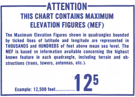
What is Maximum Elevation Figure (MEF)? It is the highest point in each quadrangle that are bounded by lines of latitude and longitude in the chart.
Whoever commandeer the plane would want to fly quickly west. It was a moonless night, so terrain features might not be easy visible. Instead of keying GPS points into the flight computer, the fastest way was to tune the VHF Omni-directional Range (VOR) radio navigation system to the Langkawi station (Identifier: VPL on 114.10 MHz). Tracking inbound and then outbound of VPL, the path could quickly take the plane from IGARI to VAMPI.
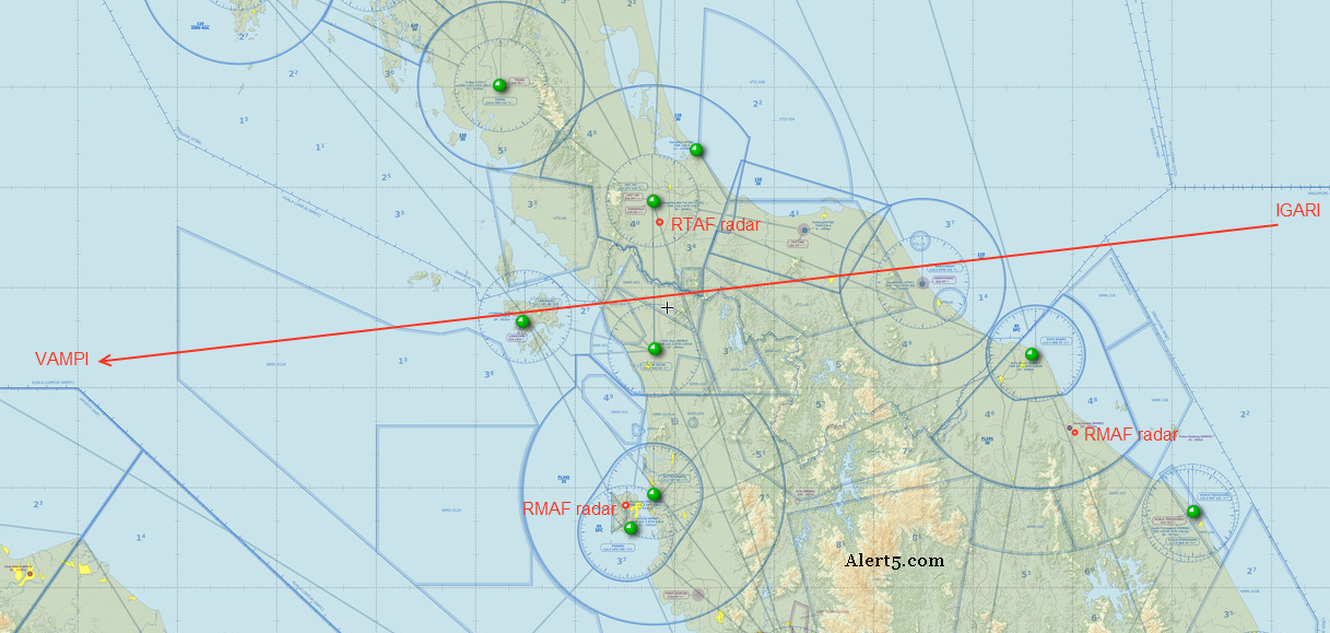
Flying at 5,000ft could allow the twin-engine jet to mask itself from Malaysian military radars located at Gong Kedak and Penang at certain points of its dash but it will be difficult to be stealthy once the aircraft is away from mountainous areas. At one time, there will be at least one radar that would have a clear look at it. And then, there’s the Royal Thai Air Force radar located near Hat Yai airport, seating on top of a hill at a height of more than 300m above mean sea level. It would be difficult to avoid detection from this radar as well. The lowest altitude to safely navigate through southern Thailand would be 4,300ft.